Friday 16th February
Forth
We left home in
Castlemaine yesterday afternoon, after a quite relaxed morning; and drove
straight to Geelong, via Ballan. Alison ended up driving through Geelong
as far as the supermarket, where we bought only a salad bowl for lunch the
next day; then I drove to Liz and Steven's house in Newtown, across the
road from the river. I parked the White House in their driveway.
We had a pleasant
afternoon, dinner, and evening walk along the Barwon River with them. Saw
over their new A-van motorhome (picked up five months ago, but not yet
slept in), and walked along the river where Liz and I, and Alison and
Steven walking a little way ahead, had almost identical conversations
about the children.
At 11-ish we had a
shower and said goodbye, and went out to bed. And were woken by the alarm
at 6am, in the dark; got up, unplugged ourselves from their house, and
drove out. 6.20am. It was very straightforward driving to the ferry
terminal, where we joined a large number of cars, caravans, and
motorhomes. After going through the first gate, and then the quarantine
section (where we had to eat the last of our plums – it was a bit sad to
see them go, after quite a bumper season) we had a longish wait. Long
enough to make a pot of tea and drink it walking around and through the
other vehicles, before it all started moving again and we drove on board.
We locked up and left
the White House and went upstairs, past two further vehicle decks, to the
“people” decks. We commandeered a table and chairs by a window just across
from the reception desk, which was a good location. A little after 8.30am
we started moving; and then had a long time to wander around the boat; and
read; and talk to others; and wander around the boat....
We were under an
unfortunately very overcast sky but on a fortunately very smooth sea. We
had our food with us; Alison bought our first coffee at the bar, but for
the second we used the automatic machine (for “hot water – no charge!)
The day was cool until
we went outside as we neared Devonport – where Alison informed me that
they keep it cool inside to lessen seasickness! We docked at ~6.30pm, and
drove off. Straight through Devonport and on, on narrow windy roads, to
the tiny town of Forth and its Recreation Ground, where we are camped.
There are quite a lot of other vehicles here, but it is fine for the
night. It was warmer here than on the boat; and very tidy, and green –
very Tasmanian! We had a little walk around what town there is (largely a
pub) and then, after 8pm, at our dinner. A (frozen) stew with cabbage and
potato in it, because we are unable to bring any fruit or vegies into
Tasmania and haven't yet had time to buy any.
Saturday 17th February Black River
We both slept really
well. A nice slow wake-up, and a shower (we were too tired, and too clean,
to have one last night) and then off we set. Most of the other vehicles
here, were still here. We drove back to coast, at Ulverstone, and parked
in a parking area behind the shops; walked down to the river, along to the
sea, up to the main street; a coffee at one of the many cafes; and then to
a supermarket where we loaded ourselves up with vegies, fruit, and other
oddments.
From
here, it was only another 12km along the coast to Penguin. We took the
scenic coastal route; and while it was coast, it was not beach – it was
all rocky. We stopped in Penguin for a walk, went to the Tardis book
exchange next to the Big Penguin, and had a pie and sausage roll (both
rather disappointing) in another cafe. Tourist info was open , so in we
went; walks in the Deal Range. We drove up to Ferndene, where we'd
wondered about staying there; but the picnic area was right next to the
road with farms on the other side. So, no. But we did go for a walk by a
creek, through lovely ferny bush, up to a couple of old mine shaft
tunnels. The further one, Thorsby, went horizontally into the side of a
hill for ~ 100 metres, before getting a grid preventing one from going
further, to a very deep vertical shaft. Luckily someone had come with a
cordless angle grinder and removed one of the bars, so you could climb
through.
We
returned, and had a coffee at the picnic tables where the van was
parked. It had become a warm sunny afternoon after this morning's
overcast sky. Back to the coast, and along to Burnie. Burnie was a big town, and not very easy to navigate;
pay parking everywhere, no sign of any tourist info, and a huge ocean liner in port. We needed a little
more food, so we drove up to another supermarket; and then left town.
We
continued along the coast, looking for somewhere for the night. We didn't
find anywhere; it was farming country all the way along. Our camp book
said SC motorhomes could spent the night at Wynyard Showgrounds, but when
we got there a sign said “no camping – including motorhomes”. So off we
went again.
Our walks book described a good walk at Rocky Cape NP.,just before
Stanley. We continued along the coast, finding nowhere to stay; drove into
the National Park, and ended up at the end of the road, at the lighthouse.
The park said “no camping” when we drove in, but there are no signs here;
so... we have parked ourselves unobtrusively and hope to stay. It is quite
windy, but sunny and warm with good views.
But it didn't work. As we were cooking our dinner, a walker walked by. I
went out; he was a National Parks employee, and so... we couldn't stay for
the night. Oh well. So after dinner (with a glass of wine) it was back out
to the highway, and on westwards. A NP campground at Pegg's Beach was very
unappealing; further on one at Black River was much better – further off
the road and very spread out. The charge was $13.00 “pay and display”, but
we had only $10.50 in small denominations. So it stands.
So
we parked, at near nightfall; went for a brief walk. It is quiet and
secluded and legal, and certainly the best option for tonight.
Sunday 18th
February Black River
We
began the day, after getting up, with a walk through the campground to the
boat ramp, onto the river beach, and around to the sea beach. It is a
lovely spot, and the camping sites are really widely spread out. But it
was time to leave; today's plan was a 19km 6-hour loop walk in Rocky Cape
NP. So we drove the 12km back there again, parked, and made ourselves an
early coffee before setting out. We left at 10.30am, on the track which
went quite steeply up a hill.
In a way, this set the tone of a lot of the walk; despite the highest
point being at ~260 metres altitude, I had turned “All Trails” on, on my
phone; at the end it said we'd done 962 metres. There was a lot of up
and down. We went along the tops to the other end of the park at Sisters
Beach, then descended to look at Wet Cave (unimpressive) and then Lee
Archer Cave, a more impressive one. From here, the instructions said to
return to the main track (up again!) and go along before descending to
Anniversary Beach. Three sides of a square. We opted to descend to the
beach below and rock-hop around to the beach. The tide was out, and it
wasn't difficult; and Anniversary Beach, with the tide out and a huge
expanse of white sand, was stunning. At the other end, we walked over
the track onto the next “beach”; meeting a lone walker coming the other
way who advised us to turn around; his traverse of the rocks had taken
2½ hours!
Rocky Cape doesn't have its name for nothing. There are beaches, but there
are a lot of rocks – mostly as angled strata running out into the sea.
There are a huge amount of them, and they are very photogenic. We were
prepared with our walking poles, which our book had recommended. Rightly
so. We found the crossing quite pleasant, and it took us 45 minutes.
Interestingly there were “roads” at times between the upturned strata,
which made the going sort of easier.
Then it was uphill again to Postman Pass, and then a descent back to the
car. We were both hot and tired; it had been a cloudless warm day, and
we'd drunk all of the four bottles of water we'd taken. We drove out and
bought icy poles at the store on the highway before returning to Black
River campsite. There was someone in the spot we had yesterday, so we've
gone further, to No. 13. We paid our camping dues (including the amount we
were short yesterday) and a very decent shower. Clean clothes. Clean hair.
And, since then, we've done very little. Don't have the energy for it!
Monday 19th
February Stanley
Naturally, we slept like logs. And on waking, decided to be extravagant
and have another shower. So we did, and left our very nice
campsite clean and fresh.
The drive into Stanley took all of ~20 minutes. We glanced at the
Showgrounds camping, but it didn't appeal; so we went to the only other
alternative, the Big 4 Caravan Park. It's quite crowded (only unpowered
sites available – fine for us) but the site we've been given is fine –
quite spacious, at the far end of the park.
So
we began with a load of washing; and airing the sheets; before riding our
bikes the very short distance into town, via the tiny supermarket. We'd
been looking forward to bread – but no, nothing there we'd spend money on.
We had a coffee in a cafe, and rode up and down the main street. Every
second building was “boutique accommodation”.
Back home, Alison made muffins for lunch and a carrot cake as well, before
we rode out to Highfield House, a historic house 2km north of town. It was
an interesting place to visit with lots of information about the history
of the house and of north-west Tasmania. While we were there, Rita rang to
say that She, Rob, and Stephanie had arrived in Stanley.
So
we rode back to the swish apartment they are in, said hullo as they were
going off for Rob to have a swim; re-packed the bikes and had a quiet
coffee before going back – to cook dinner. So we all ate together with a
lot of chat until 8.30pm, when it was time to go down to the Little
Penguin viewing area by the cemetery. We saw quite a few penguins coming
ashore, and many more people watching them. It got quite cold. Towards the
end, we lost Stephanie; we all walked back to their apartment together,
with Rita worrying and worrying about Stephanie – perhaps she's been
abducted? We left Rita there making a cup of tea and walked back, to find
Stephanie coming towards us before we'd gone halfway.
Dessert, and a cup of tea, and we walked back to the White House along the
seafront seeing a number of more penguins, closer, on the way.
A
strong wind has sprung up and we are glad we've taken our awning down!
It has been good to see Stephanie again and I think she has appreciated
a bit of dilution of Rob and Rita. She told us that Rob and Rita have
left something behind in every place they've stayed; we've been
commissioned to pick up Rob's computer and some books from their Hobart
accommodation.
Tuesday 20th
February Arthur River
The strong winds kept up all night, buffeting the van a bit. This,
combined with thick cloud cover and a very warm night, made it harder to
sleep than usual. We went over and each had a long hot shower, then packed
up and drove up to where the others were staying. We had breakfast with
them, and then said goodbye as they were packing up. Better for us to stay
out of their way.
We
showed Stephanie the White House, then drove up to the base of the
chairlift going up “The Nut”. We didn't use it; we walked up the very
steep – but concreted – zigzag path to the top; and then walked along the
circuit path on the top, clockwise. Good views all around, but big stands
of introduced gorse and hemlock; and the whole area peppered with
shearwater burrows. We found Rita and Stephanie ¾ way around, going the
other way, in a little area of bush with pademelons everywhere.
Back down at the base, we said a final goodbye to the others and drove off
to Smithton.
Smithton is the main town in this area, but it's not a big town – though
it does have two supermarkets, a Woolworths and an IGA. No banks though,
although a Bendigo Bank branch is about to open. We walked around the
town, had a coffee and bought some bread rolls in a bakery, stocked up our
food, and drove out west to Marrawah. Here, there's free camping area at
Green Point; it was very unappealing. But we had our lunch in the day use
area, inside the van because the wind was still very strong. A walk along
the coast was not an attractive option in this weather.
So
we went south to Arthur River. Here, there a five NP campgrounds. We drove
into the first one – Manuka – and it was very extensive and quite full. So
we went to the NP office in Arthur River where there was a helpful lady,
who told us a lot about our options. We drove on, going to the “End of the
World” viewing platform just south of town (a section of coastline not so
dissimilar to other bits) where we had a coffee and found we'd somehow
lost our information brochure on the Tarkine. How? One of life's little
mysteries.
Back to get another brochure, then on again and into Prickly Wattle
campground – which is much less congested than Manuka. So here we're
staying, in a big open area which is quite well sheltered by bush around,
and the wind seems to have dropped anyway.
Alison's doing her photos. She does this staring intently at the screen
with a look of displeasure (she tells me it's staring intently) which I
try to just ignore.
Wednesday 21st
February Lake
Chisholm
The wind dropped, we were sheltered, and I slept much better. We continued
on south, the Nelson Bay; here, there's another NP campground (not nearly
as nice as we had) and a walk to some aboriginal petroglyphs at the mouth
of Sundown Creek. We walked along the beach – a fairly typical west coast
beach, with lots of rock outcrops and big waves – but didn't find them. We
did find a seal basking on on of the rocks; I nearly walked into him.
We returned, talking to a couple who'd also come to see the petroglyphs.
They had a better map. We looked at our instructions and decided that,
if we'd followed them, we may have found them; so after driving out, we
drove back in again; walked along the inland 4WD track, as advised, and
found both them and the other couple. So we walked back along the beach
chatting.
We
stopped and had our morning coffee at Couta Rocks, where the road went
inland to the Tarkine; then went inland. The road was fine – all sealed –
but we did too much driving today, and I think the Tarkine is over-rated.
Fine if you want to do a lot of driving on windy roads through the bush,
but....
We
did a little side-trip of 5km rough gravel road to Trowutta Arch, a rock
arch over a couple of sinkholes; it was very nice, and the bush – lots of
beech trees and tree ferns – was lovely. Then on to Lake Chisholm, a large
sinkhole lake surrounded by the same sort of bush. It's very nice here,
and after walking down to the lake we decided to stay. We moved to a not
so obvious spot, where we found that we couldn't pull out our step. We'd
felt a “thud” both times driving out from the petroglyphs, which obviously
was something which the step hit. What? We saw nothing.... but.....
I
managed to sort of straighten it so I could remove the step, but it needs
something more than I have here. We'll just have to go without for a while
– no big issue. It has just annoyed me!
We
walked back to Lake Chisholm in the late evening, where after watching
intently for perhaps 15 minutes we had a glimpse of a platypus in the
water. A few very brief views, but it was definitely a platypus.
Then – back home – we watched a bit of DVD; the first time this trip. To
settle my grumpiness down.
Thursday 22nd
February Hellyer
Gorge
This was a very quiet spot; but it was a very warm night, and (after
yesterday, not so surprisingly) I slept poorly. We woke to a cooler
morning and birdsong – but birdsong less intense than we get in
Castlemaine.
Last night, I'd had the revelation that the 20cm ground clearance needed
to go on the ferry at Corinna may be something we lacked; I measured it,
and found we had only 15cm. So that route south, our intended one, was out
of the question. So... we had another shower, and washed our hair, as
we'll need to go via Wynyard and should be able to refill with water
there. We drove a short distance to the Julius River picnic area, and went
on the 2 short walks there – nominally ½ hour and 1 hour, but we did it in
less. Both very nice rainforest walks, one of them sporting a varied
fungal “garden” at the base of an old tree.
Then it was out of the Tarkine, back to Smithton where, at 11am, we
revisited our cafe before driving on. Past “The Nut” and Rocky Cape,
neither of which were very visible because of mist. We we lucky we went to
them when we did. And on to Wynyard.
Last time, when we drove through, we saw nothing as we were on an abortive
quest for somewhere to stay there. This time was different. We found the
tourist info near the middle of town; they had parking for extended
vehicles there, and they allowed us to stay as long as we liked. Tourist
info were helpful; we walked around town, went to the supermarket; had a
very nice lunch in the van; refilled ourselves with both fuel and water,
and drove out south.
The road was very windy, but the traffic on it was light. It took nearly
an hour to get to Hellyer Gorge, where there's a camping area. Quiite a
few others here but we managed to get a good spot with bush outlook at
the far end. It's nice. (Though it is very humid, and someone has lit a fire.
We don't like fires.) And I think I've got over yesterday's grumpiness.
Tomorrow? We make sort-of plans, but they change a lot!
Friday 23rd
February near Tullah
As did the weather. We had a lovely sleep under the covers, and didn't
really wake till after 8am. We were in no hurry to leave 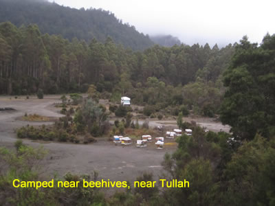 and most of the others
went first; we drove down the highway to Waratah. On a main road, at 50
– 60km/hour, and no-one came up behind us! It was a pleasant
drive; but.... in my shorts, when we left, the car said 12º; by the time
we got to Waratah, 9º. I changed into jeans, jacket, and rainproof
jacket; yes, the rain had begun and it continued on and off all day.
and most of the others
went first; we drove down the highway to Waratah. On a main road, at 50
– 60km/hour, and no-one came up behind us! It was a pleasant
drive; but.... in my shorts, when we left, the car said 12º; by the time
we got to Waratah, 9º. I changed into jeans, jacket, and rainproof
jacket; yes, the rain had begun and it continued on and off all day.
I
hadn't known how big Waratah was. It turned out to be tiny. We walked up
past the waterfall in the middle of town to the pub, where we went into
its cosy bar for a coffee. Then we kept walking anouther 10 minutes to the
fossicking area, next to the mine at Mt. Bischoff – which was the first
mine in Tasmania and the biggest tin mine in the world. The rain came and
went but Waratah is in a very pretty location. We looked in at the
restored stamping shed (where ore was crushed) in the main street. The
town has a very interesting history.
We
retired to the shelter of the van for lunch (yummy fruit buns warmed in
the oven) before driving 10km further to the start of the walk to
Philosopher's Falls. This was an excellent walk – the falls were OK, but
the walk to and from was lovely, through the lushest mossy forest I've
ever been in, And not only moss, but a huge range of fungi is various
shapes and colours. It was just lovely, and it has restored my
appreciation of the Tarkine – though it in out on one edge of it.
Back into Waratah. 4pm. Stay for the night? Go on? Partly because of the
300+ people arriving in town for a big fun run tomorrow (along to, and
past, Philosopher's Falls – we'd seen lots of preparations for it,
including a portable toilet halfway along the road) we decided to go. On
south towards Tullah.
Our camps book showed a spot on Lake Mackintosh, 6km off the highway.
There we went, and found it very unappealing – a flat (muddy in parts)
area with 5 or 6 vehicles parked in it. So after a look at the lake from
the boat ramp, we retraced about 1km to where we'd seen an open area with
beehives in one corner. It's a pretty spot, level, sheltered, with a good
surface underneath – which is relevant in the rain.
We
have chicken roasting in the oven for dinner, while the rain continues on
and off. The car heater was on full for the drive here, but we may end up
using the diesel heater as well tonight.
(We didn't, but we did break out the extra doona).
Saturday 24th
February Henty River,
near Strahan
The rain stopped. The sky showed small patches of blue. We drove out of
our lovely overnight spot and drove into Tullah. Tullah is obviously a
hydro town; we went to the main square (mostly deserted) then back to the
highway to the parking area for the walk up Mt. Farrell.
It
was still cold. We made a coffee before setting out, and carried a thermos
with us; along with my shorts in the backpack. Unusually for me, I set off
in jeans and jumper.
The track almost straightaway started going steeply uphill through gum
trees. And kept on like that for over an hour, when we emerged above the
treeline onto a buttongrass (sloping) “plain”. Steep uphill had already
made me shed my jumper, and soon after getting to the plain I had to
change into shorts.
It
kept going up. We had good views over Lake Mackintosh, and at one stage
saw the small Lake Herbert above it. A steep climb got us to what we
thought was the summit, but it wasn't; the real summit was further across
a ridge and little higher than we were. We didn't go there; we had our
coffee instead.
Back down, and despite not having intended to, we of course went across to
Lake Herbert as well. A lovely lake and not really so small. And then a
long descent back to the van.
By
now, it was 2pm. After a little circuit of Tullah (the Lakeside Resort
cafe not so appealing) we drove another 20km to the mining town of
Rosebery, and had lunch in the park next to their community garden. In the
sun! By now it was blue skies again and the temperature had got to the low
20's. It was pleasant, and we had some of the garden's strawberries and
blackberries before driving on.
We
drove around Zeehan but didn't stop. Another small mining town. The plan
at present was to stop somewhere before Strahan tonight, look around the
town in the morning, and go on to Queenstown. We were going to start
looking for a spot 15km before Strahan, but found a nice flat spot next to
the Henty River 20km before. So here we are.
We
went for a walk down tracks beside the river, through a tree fern forest,
before dinner, for ¾ hour or so.
Sunday 25th
February 10km east of
Queenstown
Despite being next to road, there was little traffic. We got up to another
overcast morning; it was not warm, but I put on shorts anyway. I managed –
just – to not change out of them all day.
We
drove along into Strahan, where it had been raining – past the caravan
park, which was large and was chock-a -block. There was limited free
parking, but we found a spot outside tourist info. Closed on the weekends!
We walked around the shore of Macquarie Harbour for 40 minutes, seeing
occasional dog walkers but no-one else. Where are all the people?
A
few people were at a little cafe. We stopped there for a coffee, and
chatted to a couple from Bundaberg. They wanted to go on a Gordon River
cruise but they were all booked out. Maybe that's where all the
people were.
Anyway – it was a very quiet and very touristy town, but little was open.
So we left there and drove along the windy road to Queenstown. The area
around Queenstown was so much greener and more vegetated than when we were
last here 30 years ago! We stopped and went for a walk, looking for
Tourist info. We never found any. But we did find a laundromat, so we
drove up there and put on the washing; went for a walk down to the
restored railway station, for the restored steam train which runs along
the restored line to Strahan. We had lunch of chips and a panini in a
cafe.
The other thing we needed was water. There was no evidence of it being
available anywhere, and no-one relevant to ask. I even did a fruitless
google search. Alison asked and found out where the caravan park was (we
would never have found it!) and for $5 they let us fill our tank.
An
RV friendly town Queenstown certainly isn't!
By
now, it was mid-afternoon and we'd had enough of the place. It was getting
drizzly and colder too. We drove out, and stopped at the Horsetail Falls.
Here, there's a short walking track, mostly cantilevered out from the side
of a bare hillside with interesting rocks in it. So we walked out to the
viewing platform and back; the walk was the highlight, rather than the
falls.
Then, in poor weather, we drove out to the Iron Blow lookout, over the old
open cut mine. As open cut mines sometimes are, it was quite beautiful
with strata of different colour rock in the walls, and a lake in the
bottom.
We
continued, looking out for somewhere for the night; and found it just past
a bridge over Lake Burbury. Again, quite near the road but a sheltered
flat area with a very short walk down to the lake shore. And here, the
weather has settled down a bit.
Monday 26th
February Derwent
Bridge
It
rained quite heavily during the night, and we were happy to be cosy and
warm and dry in the van. Today, we had a little driving and three short
walks; the first one, to Nelson Falls, was a remarkably good walk through
mossy forest to some much better than usual falls.
Back in the van, we had the heater on full; we drove along to the next
walk, to Donaghy's Hill lookout, with the outside temperature vacillating
between 8º & 9º. I was hoping that when it got to 10am, it would get
up to 10º. It didn't. I gave up and changed from shorts into jeans and
jumper. I stayed in them all day apart from a few short breaks when my
jumper came off.
The lookout was good; for a little of the time the sun came out and we
were able to appreciate it. We passed the start of the walk to Frenchman's
Cap, where ~ 15 vehicles were parked; I was surprised by the high number.
Then it was on to the next walk, Franklin River Nature Trail. This was
short, and not nearly as good as we are used to; though it did have the
“Specular”, a large stainless steel sculpture covered in convex mirrored
surfaces.
By
now, it was lunchtime; and we went to Derwent Bridge. This village is much
bigger than it used to be; we passed masses of caravans parked in front
of, and over the road from, the pub; a free camping area where I don't
want to be. On to the “Hungry Wombat” cafe, where we each had a hamburger
– as recommended by the author of our walks book. It was a good lunch,
eaten outside in the trying-to-be-warm sunshine.
We
went from here to “The Wall”, the large bas-relief huon pine panels carved
by Greg Duncan. We saw it eight years ago and it is as good as it was
then. We spent quite a while there, Alison also being taken with some
drawings by Lisa Falk. They were very impressive.
We
have camped for the night just outside Derwent Bridge, at King William
Lake; though the lake is empty, with just the Derwent River running
through it and the stumps of previously drowned trees. It's a good
campsite; a very large area with perhaps five other groups scattered along
it.
Alison read in the last of the sun; I replaced my bicycle's flat front
tyre with another tube. It didn't work. I'm a bit down tonight and that
may be part of the reason; I don't know. I get like this sometimes and I
don't like it!
We
did have a pleasant walk around the area before the sun went down. And
tonight, I've turned the diesel heater on. In summer!
Tuesday 27th
February Lake Binney,
near Tarraleah
For a change, we woke to a blue sky. Still chilly, but I went back to
shorts again; and we drove off to Lake St. Clair – which was just as we
remembered it. We had a coffee sitting next to a shelter, in the sun;
there were picnic tables too, but they were all too breezy. And the, we
set off on the 5-hour loop walk to Shadow Lake.
Despite the fair number of vehicles in the car park, the walk was not
crowded at all. It spent the first hour or more going upwards – not too
steeply – through varied forest; after the turnoff to Mt. Rufus it then
went down again, at one stage across a fern plain. We stopped for a break
at the lake – quite large, with “Little Hegel” mountain beyond it; but
really a poor cousin to Lake Herbert.
Up
past Shadow Lake is the smaller Forgotten Lake; we walked up for a look.
It wasn't really worth it, but we did pass numerous campsites on the
eastern side of Shadow Lake where it has a gently sloping sandy shore.
Quite a nice spot, but no-one was camping there.
Then we walked back down again. It wasn't nearly a good a walk as many
we've been on recently, and our opinion wasn't helped by the final
20-minute walk back along a gravel road we remember from the Overland
Track – a real downer after a good walk.
Alison remembered there were showers at the Visitors Centre. That's where
we went, and had long hot showers and washed out hair. Dressed in clean
clothes we went and had a mediocre coffee at the cafe before driving out.
(I
asked how many walkers per day were allowed to walk the Overland Track
now. 34 people per day, was the answer; when we first walked it, it was
200!)
Out. We don't really find much to attract us to Lake St. Clair. It was
back to “The Wall”, where Alison was interested in buying a Lisa Falk
print of South Cape Rivulet. We arrived just before closing time, to
closed doors; I had to ring them up to be allowed in. But it was no
trouble, and the print is bought. Then on towards Hobart, because tomorrow
we are booked in for a distillery tour and lunch at Kempton. We found a
lovely camping spot on Lake Binney, close to the road but in bush near the
lake; the only disturbance being a fire-fighting helicopter coming a
filling a large bucket from the lake. But it stopped coming after ¾ hour,
and Alison trimmed my hair down by the lake before cooking another
delicious dinner.
And we watched another episode of “The Beautiful Lie”. And took some
photos of moonrise over Lake Binney.
Wednesday 28th
February “Rosedale”,
Port Arthur
Today was quite a big driving day. We are not so used to them now.
My plan had been to leave by 8am. We didn't try too hard, and Alison
helped me feel better, but even so we left at 8.20am. It was down the
road past Tarraleah (now “Tarraleah Estate”) through thickening bushfire
smoke. We drove out of the bush we'd been driving through for days, into
open farmland; and soon after through the town of Ouse. Ouse was
chock-a-block full of fire engines, ambulance, police, Parks &
Wildlife workers; the bushfire nearby is obviously still a big problem.
While I felt a bit sad to drive out of the bush, with bushfire risk it
also felt a bit safer.
We
swapped drivers. We stopped in Hamilton (a pub and little else) where
there's a very well equipped overnight stop with even hot showers! On
through Melton Mowbray (also a pub and little else) to Kempton, which is a
little bigger.
We
were going to the Old Kempton Distillery for a tour and lunch – thanks
partly to my old work's Red Balloon voucher they gave me when I retired.
We were due at 11am, and got there 15 minutes early. Not bad timing!
The distillery is in the old restored coach house built in 1824. It is a
lovely old building; and we were the only visitors the whole time we were
there. After a personal tour of the distillery, with Craig, we had a
platter lunch in their courtyard. All by ourselves! And we left with four
little sample bottles of their whisky.
Then? Next destination was Port Arthur, so we worked out a cross-country
route to get there, via Sorell – where we stopped for a walk. While it
has Coles and Woolworths supermarkets, there's not a great deal more to
see in town. We went to the Salvos Op Shop and Alison bought a nice
dress. Then driving again, seeing signs to lots of distilleries, down to Port Arthur –
looking for overnighting stops on the way, and not finding any. We
stopped and went into the cruise office to make sure we're down for the
Tasman Island boat trip in the morning, and to see where we could park.
No problem there.
The camps book said free camping at Nubeena RSL. We went there, to find a
smallish, fullish parking area and a fee of $10. I wasn't attracted; we
drove on the another spot the lady in the cruise office had suggested, at
Taranna. Closed, and the gate locked. I rang their number and was told how
to get in. It is in a wildlife park, which is all a bit run-down – thanks
to Covid and the ill-health of one of the couple running it; and they have
just put it on the market, which would be very sad for them. They still
have a camel, emu, llama, donkeys, horses, varieties of sheep, goats, and
a multitude of birds.
There is one other couple here (Frank & Sandra, from near Brisbane)
whom we chatted to for a while. While it costs more than the Nubeena RSL,
it has showers and toilets, and is spacious and quiet, and I am very happy
to pay the owners their money.
It
has been a warm day and now it has begun to rain a little. Lake Binney,
this morning, seems ages away!
Thursday 29th
February Lime Bay
Today has been quite exciting. We went over for a shower this morning; the
lights didn't work (as they hadn't last night), but the shower didn't work
either. I got Julie, the owner, over; the problem was a tripping switch,
but it kept tripping! We gave up and went and had a shower in the van.
This was fine, except that I had to remind Alison to finish her shower!
She's used to just staying in till it starts to cool, and it wasn't doing
it yet.
We
drove down to Port Arthur and parked in the “cruise” parking area, and
went in and picked up our red waterproof coats. Everyone was given one.
And then a walk down to the boat.
This is called a “cruise”, but it wasn't so cruisey; the boat was
high-powered, and the swell in the sea was big – two or three metres,
bigger than I think I've ever been in in a small boat. But it was a very
good trip, for three hours or so; a look at Port Arthur penal settlement
from the sea, a look at Cape Raoul in the distance; Tasman Island; Cape
Pillar; and then up the east coast of the Tasman peninsula to finish at
Eaglehawk Neck, and a bus trip back to the office and the van.
We
went over the road for a coffee. (There were no refreshments on the
cruise, and having been on it one can see why; the only food we were given
was ginger seasickness pills as we set off.) Then we drove down to Shelly
Beach for a late lunch, before heading north up to the Coal Mines historic
area.
This was interesting; a branch of the penal settlement, where coal was
mined (using prisoner labour) for the penal settlement; ruins of a lot of
old buildings over quite a large area. And coal visible along the
shoreline in one spot. We spent a couple of hours wandering around the
site.
Then on the the NP camping area at Lime Bay, where there a quite a few
other vehicles but we have found a reasonable spot. We cooked dinner using
our barbecue plate for the first time (very successful), then went for a
walk along the beach and rocks – where we had a long phone call from Alice
till we were home and finished washing up!
Friday 1st
March Bellerive
The gas ran out in the early morning – it lasted two weeks of fairly
constant use. So after waking up (too early, for no good reason) one of
the first things was to change cylinders. Then a little walk along the
beach we hadn't walked last night, and we packed up and drove out. It was
a reasonably long drive; slow gravel road to past the coal mines, then
windy bitumen; very little straight road in these parts. We drove straight
along and off the Tasman peninsula, swapping drivers on the way somewhere
near Eaglehawk Neck. And on to Sorell, which we looked at more and had our
11am morning coffee. It's a little bigger than we thought last time.
We
bought some bread in Sorell – such an unusual thing for us to be able to
access, lately – and stopped for lunch at 7-Mile Beach. And then drove on
to King St., Bellerive, where we were welcomed by Brian & Vicki. We
sat and had a cup of tea, and talked.
Near 5pm, Alison went with Vicki to an art opening; Brian and I attended
to the two tasks we needed. The flat bicycle tyre, and the squished van
step.
The puncture in the “new” tube was identified, and a patch put on it –
unsuccessfully; perhaps due to the age of Brian's repair kit. So I've
put the next new tube in it, and I'll take the old one
home.
We
straightened the cover plate of the step; but then …. decided that,
really, taking the step off would be sensible, to be able to repair it
better. So, with quite a lot of effort, we managed to do it. Now it's
partially dismantled in his shed, and there's no doubt that it was the
right course of action. Tomorrow? Sunday? we'll take it further.
But it was time to meet Alison and Vicki at the local pub for dinner; each
couple shared one main course each, and it was plenty. We had dessert – a
yummy cherry tart – back home with Elise, who's staying the night because
her phone's not charging. So we heard a lot from her over a cup of tea
after dinner.
And tonight, we're sleeping inside with a bathroom with shower next door!
Which is nice, but.... living in the van is nice too.
Saturday 2nd
March Bellerive
We
slept well inside; I got up and put on shorts, but had to change into
jeans after going outside. We put on a load of washing, and breakfasted,
then walked down to Bellerive Pier at 9am to catch the ferry across to
Salamanca. This was easy, and was quite pleasant – certainly a good way to
get there.
It's a long time since I've been to a Saturday morning Salamanca market;
it was both more extensive, and busier, than I remember. We walked through
it for a while, seeing lots of things – but buying nothing, because we
don't need anything. Interestingly there were lots of distillery shops;
probably one in fifteen or more were selling alcohol.
Alison had arranged to meet Judy Maplestone here. She eventually rang,
and we met up; and walked up into Battery Point to a cafe, and sat down
and had a coffee. On the way I picked up the parcel of Rob's things he'd
accidentally left at their apartment in Salamanca; it was no problem but
I was quite surprised by the size of the parcel. Luckily we managed to fit
it into / onto the backpack.
Coffee with Judy was not very scintillating. But.... When we left, we were
going to walk back into town, the way we knew; but Judy insisted that it
was the other way, and marched off. She left us at a park leading down
into Salamanca, and we had ended up walking three sides of a square. Why?
Town was easier. We found the banks we needed and refilled ourselves with
money, had a (rather ordinary) banh mi for lunch, then a coffee and scones
at the museum cafe, before taking the ferry back to Bellerive. A warmer
and sunnier trip than the one over. We walked back via the supermarket and
Dan Murphy's, where we bought a bottle of sparkling rose to accompany
dinner; then back home.
Here, Brian had straightened out and reassembled the motorhome step. Just
needed to be put back on.... we went out and did it. But it was in no
way straightforward, and we ended up putting it into and out of its
brackets probably ten times before we managed to do it properly. But..
in the end, we won – and it works and looks almost like nothing had
happened to it.
And, my bicycle tyre is fixed as well. All good.
Brian drove Elise home, and we had a very nice dinner here with lots of
talk till everyone faded at 10pm-ish.
Tomorrow, we have a day here with no fixed plans, before driving off on
Monday.
Sunday 3rd
March Bellerive
The wind was realy strong last night; so much so that, after going to bed,
I got up and went out to the van dressed in a towel to close its windows
and the shower vent. And for much of the day the wind continued,
accompanied by rain at times.
So
there was not the faintest thought of shorts this morning. After a slow
start – including looking at a lovely rainbow over Hobart from their
balcony - we've had a sort of “Sunday” doing not very much; Brian and
Vicki took us out to various places in their car in the middle of the day
(with Elise as well). We started at a Greek Festival which was not going
well because of the cold, wind, and rain; then up to Mt. Nelson where we
saw the view and had a coffee in a cafe there. Lunch sort of didn't happen
– replaced by Greek snacks bought at the festival.
Then, we went up Mt. Wellington, the top of which was in cloud. The
temperature – 15º at the bottom – went down to 2º at the top –
accompanied by hail and strong winds. Desppite this Alison and I got out
of the car and ran down to the observation shelter. Not for very long.
We
came home; Alison prepared dinner while I paid some bills and tidied up
computer stuff. And filled the van with water ready for tomorrow.
So
we had another pleasant dinner and lots more talking till we were all
getting tired at 10pm.
Tomorrow, the weather is set to improve slightly, thank goodness!
Monday 4th
March Lake Binney
North
We
had breakfast, said goodbye to Vicki when she left for a doctor's
appointment, then said goodbye to Brian, and drove off.  Three days with them was
good, but it was enough; time to be back on our own again.
Three days with them was
good, but it was enough; time to be back on our own again.
We
began by going to Eastland shopping centre for vegies, etc; we needed more
fuel but there was no appropriate petrol station. So we headed off north,
along the Brooker Highway, keeping our eyes peeled for one. We didn't find
one, so in the end needed to use the phone to find out where they all
were. Closest was a little way back, in Clermont, so that's where we went.
Refuelled, off we went. First stop was in New Norfolk, where we parked,
had a walk around town, bought some lovely shoes in an op shop, had a
coffee in a cafe; quite a nice little town. We continued to Hamilton and
stopped at their rest area for lunch. It is a nice spot, especially as
today the wind has gone, and it became sunny as well; a huge difference
from yesterday. So we were in no hurry. We watched as the rest area
filled up with caravans, then drove out. I was going to stop at Ouse,
now that it wasn't full of emergency firefighters, etc., but it was
small and not so interesting; so we continued on, back into the bush, to
Tarraleah.
We
drove in; a kilometre off the highway. A look at the Hydro lookout – 6
penstocks descending steeply into the valley below, where they deliver
water at 290km/hour and 55litres/second to the turbines there. Then a walk
around the town, the entirety of which has been bought since we were here
last 28 years ago; it all still looks oldish, but it is well maintained
and in much better condition than it was. It has extensive gardens, and a
golf course, and it all looks lovely.
But, despite its nice spread-out caravan park, we weren't staying there.
We continued to Lake Binney, where we spent a night about a week ago. In
we drove, but... there was another vehicle there. So we couldn't go back
to our previous spot, and had to find another levelish one. We did, and
Alison went to read by the lake in the sun. It was warm, still, and sunny.
But the man in the other vehicle was lighting a fire. We don't like smoke;
so I thought of the other side of the lake. Too far to walk, so I rode my
bike over (2km?) and found North Binney campground; a scenic location on
the edge of the lake, quiet, level, and empty. I rode back, and we drove
over. It is a lovely spot.
And here we're staying. Had a little walk along the shore, saw a lovely
sunset over the lake; it would be hard to do better than this for the
night.
Tuesday 5th
March Lower Liffey
Reserve
It
was a cold night. Borderline cold enough for the extra doona, but neither
of us put it on. It meant there was little incentive to get up; but, after
25 minutes to heat the shower water, we did. It was after 10am when we
finally drove out.
Up the highway, turn off 4km to Bronte Park, where we found no good
reason to stop; then it was onto a wide gravel road for 28km to Miena.
It was quite driveable, but – for us – slow. Mostly in 2nd
gear, at ~20km/hour. But we were in no hurry, and the road was quite
scenic, so it was fine.
About 2/3 way along, we got to Little Pine Lagoon, a smallish lake, where
we stopped under the dam wall for morning coffee – along with yummy cakes
we'd bought at “.Salamanca Fresh” in Bellerive. The on the last 10km of
gravel to the tiny town of Miena, on Great Lake; we stopped for a brief
look. The big thing here seems to be fishing.
Back on bitumen, north along Great Lake, but lots of little settlement of
fishing shacks – some better than others.
At
2pm, we got to Pine Lake – a little lake, 400m off the highway, with lots
of high-altitude plants about it – especially Pencil Pines and Cushion
Plant. They survive in very cold weather, which is what we still had;
yesterday's balmy afternoon had not returned. We ate lunch in the van
after our little walk, then continued on north.
We
passed the highest point on the highway, and the road descended. We'd
decided to walk up Quamby Bluff, a 3 – 5 hour return walk. We got to the
parking area at 2.30pm and set off. Fortunately it ended up taking us only
3½ hours. I set off in shorts (it had got marginally warmer); the track
went through a fern forest, and then.... up. It was a very rocky walk,
especially when we had to go up a “Block Creek” (i.e. clamber up over
rocks) for a while.
1
hour 10 minutes in, we got to the top of the ridge. Surprisingly, from
there it was another short rock scramble up to the plateau on the top, and
then a flat walk through low brush over to the trig point, about 10
minutes away.
There were views all around, of the Great Western Tiers, and.... and....
On a clear day you can see Flinders Island, but for us there was quite a
lot of haze. But well worth the walk nonetheless.
Going down was faster. We got back to the van at 6pm and wondered – where
to go for the night? We went to look at Lower Liffey Reserve, along ~6km
of gravel road; and it's a nice spot on a creek, a large area with perhaps
eight other vehicles, and here we're staying.
We
went for a walk at dusk and saw a platypus in a pool near the bridge.
Wednesday 6th
March Narawntapu NP
Last night, in bed, I looked in our “Top Walks in Tasmania” book, and
found there was one, to Liffey Falls, departing from.... here! So in the
morning, that's where we went – a 3km each way return walk beside the
Meander River (which is crystal clear!), through tree fern and myrtle
beech forest. It was really nice. And, as it sometimes is, the walk there
was the highlight rather than the falls at the end – though they were
pretty good too.
Back home, we had morning tea (we've run out of coffee!) and moved the van
so a family from Karratha, with three daughters and a big caravan, could
have our spot. Then it was time to leave.
How? Back the way we came? We decided to go the other way, through Liffey.
We found that Liffey was hardly a town at all, and it probably was a
longer route to Deloraine, where we were going. We drove quite a long way
on quiet roads with little signage, but eventually got there. Went to
Tourist info to find where the supermarket was (it's a big one, but quite
hidden in the middle of a block), and where we could refill our water.
We
bought hot cross buns and coffee in the supermarket, and went and had a
picnic at the riverside park. It was sunny and warm.
We
went and refilled our water and looked at the no-facilities RV parking
area in town; it didn't appeal at all. So we parked behind the main
street, walked up and down it, and had a pleasant coffee with a paper to
read.
4pm came along; time to think about where to go overnight. The closest
good option was last night's spot; but Alison found Narawntapu NP, up on
the north coast east of Sorell. And there we drove, looking vaguely for
alternative spots on the way and finding none. So we got to Narawntapu,
where there a four campgrounds. We drove past the first one, Horse Yards
(catering for horsey people) which was empty. Then to Springlawn, which
was full (it has showers!). Then we tried going along the gravel road 5km
to Baker's Point, but it was dreadfully corrugated; after 1½ km we gave up
and turned around.
We
drove the ½km non-corrugated road to Baker's Beach, walked on the
expansive beach, went back to the Visitors Centre and made dinner on one
of their barbecues. And ate it on a picnic table in the sun. It was nice.
Then – back to Horse Yards, where we have the place to ourselves. It's a
nice spot. Alison of course wanted a walk, and saw the sea was very close;
so we tried, and succeeded, in getting there – despite what looked like an
impenetrable wall of trees. Not really an official track, though.
Now its 8.15pm, getting dark; still quite warm; and we have a full tank of
water and only two days to use it in.
Thursday 7th
March Forth
Today, we were meeting Helen (Dooley) & Michael for lunch; so we had
to get going a bit earlier than usual. So soon after 8am we drove down to
carpark no. 1 along Bakers Beach, and set off on the inland walk along to
Archer's Knob lookout. According to our map, it was meant to get to a bird
hide; despite walking back in the wrong direction for a while, we never
found it. So off we went to Archer's Knob. There were masses of wallabies
and pademelons and smaller animals as well.
The track was very sandy until it got to the uphill bit; and from the top
the view, especially along to the west, was very good. The way back led us
down onto the beach, where the tide was out and the sand (fortunately)
firm, so walking was easier than on the inland track.
We
drove back to the picnic area and had a coffee, accompanied by the last of
our home-cooked biscuits. They have lasted very well.
Then, out of Narawntapu NP, and along to Hawley Beach. We met Helen &
Michael, walked up to see their house being built there (in its very early
stages), and then went out to lunch at Ghost Rock Winery. A nice lunch
(which they paid for!) and we stayed chatting for over two hours. It was
good.
We
said goodbye, and continued in Devonport. With not too much trouble Alison
found the Woolworths carpark; we parked there and went for a walk. But not
for very long; it's a big city and not really our thing. So we returned,
bought some food for dinner and for the boat tomorrow, and returned to
Forth where we spent our first night here. Only 15 minutes drive from the
ferry tomorrow.
It's a sunny warm afternoon. A glass of wine at the pub to “celebrate” the
end of the trip? But, it's not really our thing – we went for a walk along
the road beside the river instead.
Friday 8th
March On the boat
home
The alarm was on for 6am; I woke before it. We got up, got dressed, and
drove out in the dark to the ferry terminal, and joined the queue. Here,
we had breakfast (which involved surrepticiously turning the gas on, after
it had had to be turned off prior to boarding the ferry. I did turn it off
again after making a pot of tea.)
And now it's back to Victoria and our “normal” lives.
We've spent 22 nights in the van; one night in a caravan park, seven in
national park campsites, and the rest – here and there, many in very
beautiful locations. We've done many more walks from our walks book that
I'd have expected to. Had an exciting boat trip to Tasman Island and seen
around one of the any distilleries here now.
All pretty good, really.